National Weather Service issues Extreme Cold Warning and a Freeze Warning for Brevard
BREVARD COUNTY, FLORIDA – Brevard County residents are urged to prepare for a significant, potentially dangerous cold weather event as a historic cold outbreak is forecast to impact Central Florida beginning Saturday night and continuing into early next week.
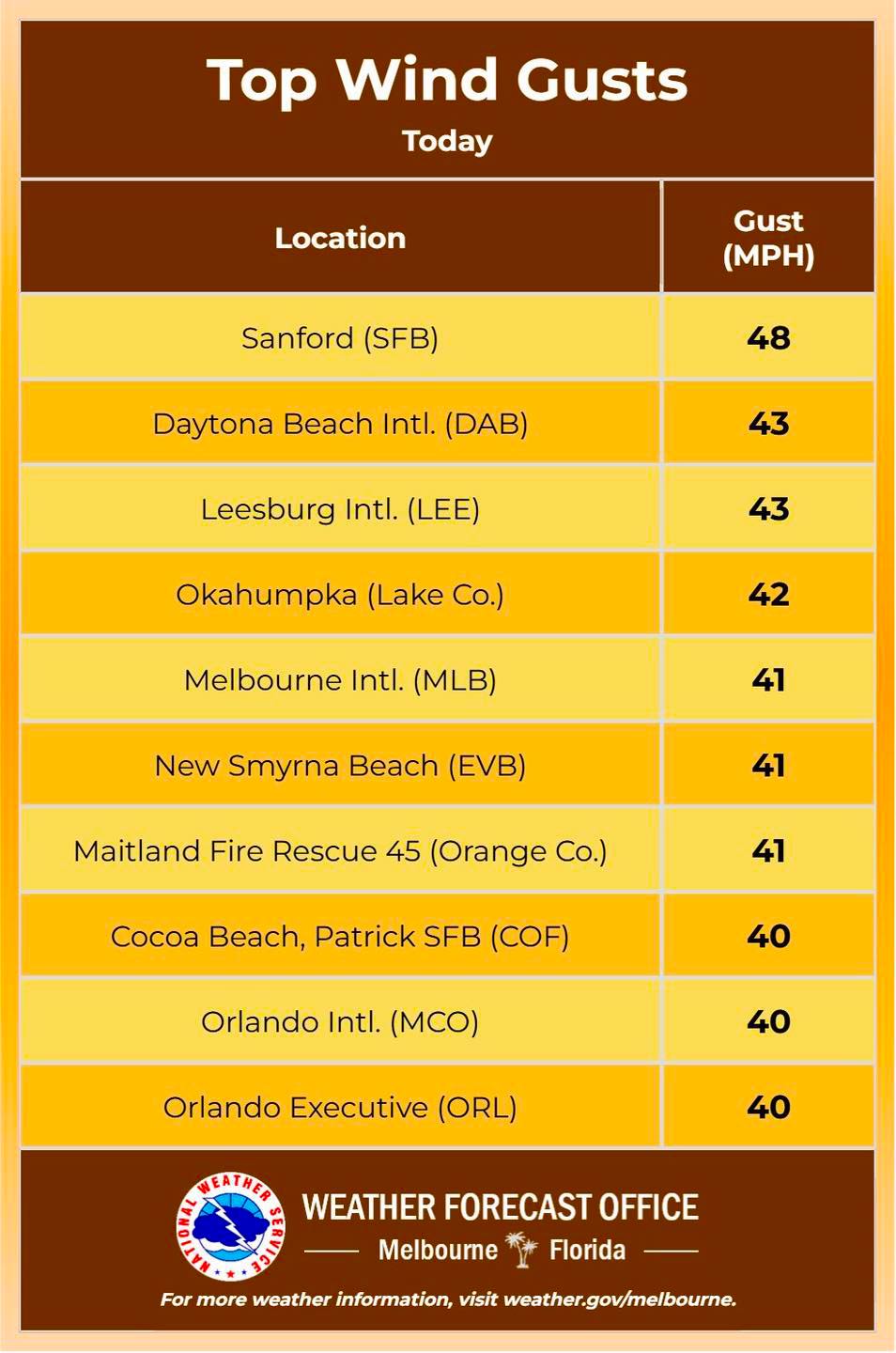
Wind gusts continue to increase in Brevard County on Saturday afternoon. Strong winds will persist overnight, resulting in bitter wind chills through Sunday morning.
Arctic air producing hard freeze conditions and dangerous wind chills moves in tonight.
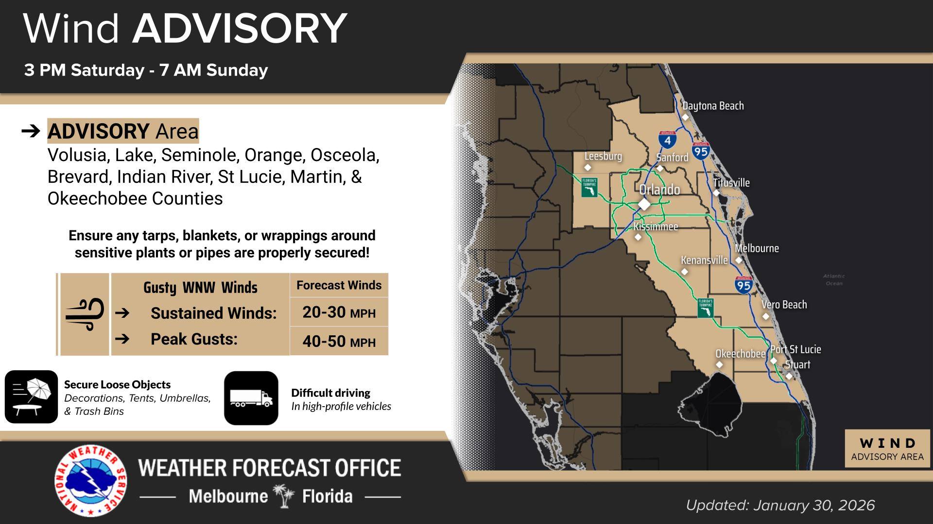
Strong winds this afternoon and will continue tonight, with gusts up to 40-50 mph. Ensure any pipe and plant coverings are properly secured! These strong winds will also create hazardous boating conditions on the water today and will continue through Sunday afternoon.
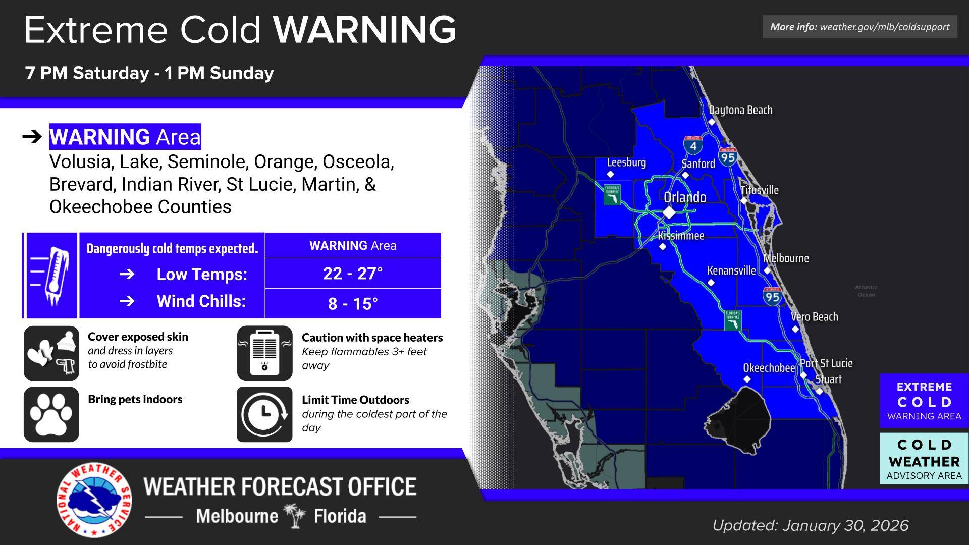
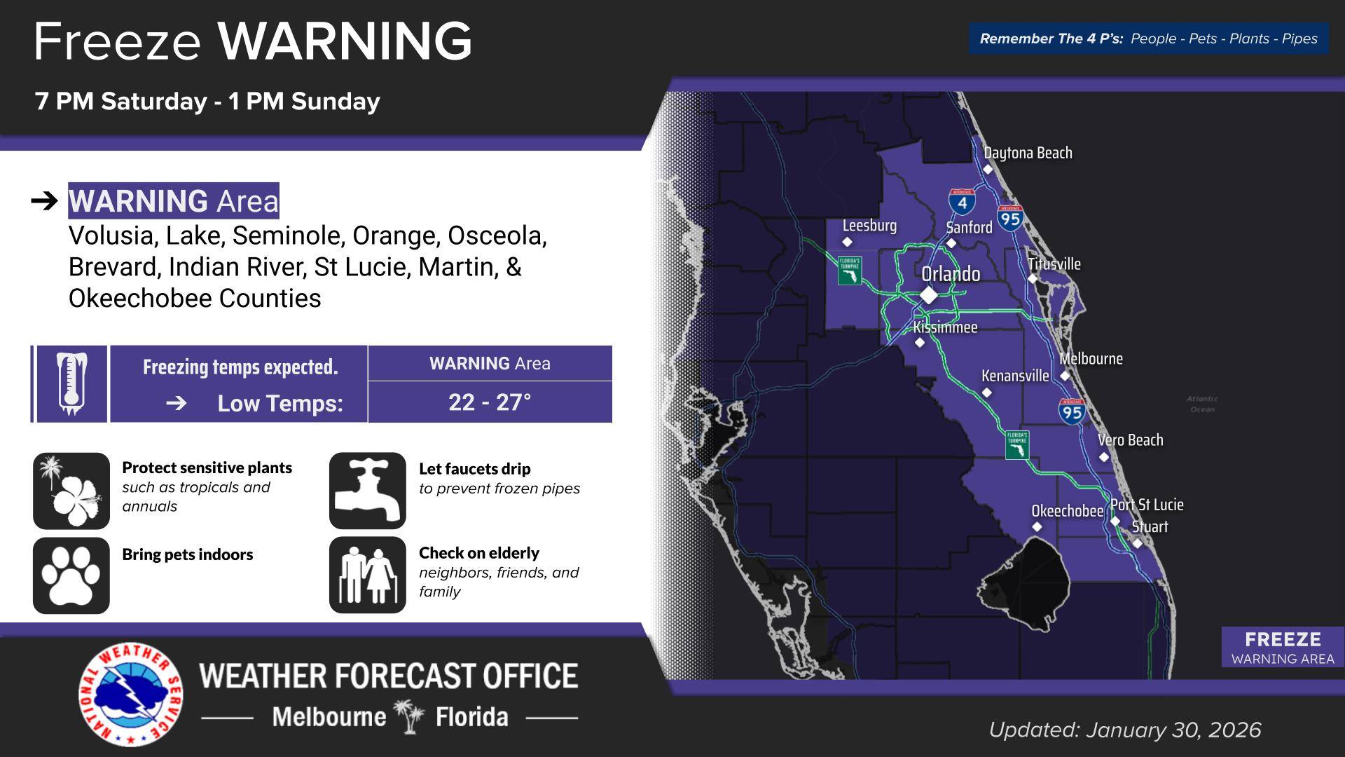
The National Weather Service has issued an Extreme Cold Warning and a Freeze Warning for the region, signaling a rare and impactful surge of Arctic air that will bring temperatures well below normal for the Space Coast.
In addition, a Wind Advisory is in effect beginning Saturday afternoon, adding another layer of concern as strong and gusty winds move into the area ahead of the coldest air.
Dangerous Cold Expected
Overnight temperatures Saturday night into Sunday morning are expected to plunge into freezing conditions across much of Brevard County, with some inland areas potentially dropping into the upper 20s. Wind chill values may feel even colder, especially overnight and in the early morning.
Prolonged exposure to these conditions can be hazardous, particularly for vulnerable populations such as the elderly, young children, and those without adequate heating. Residents are encouraged to limit time outdoors, dress in warm layers, and ensure homes are properly heated.
Windy Conditions Will Complicate Preparations
Ahead of the cold air, strong northwesterly winds will develop Saturday afternoon and persist into the night. These winds may gust high enough to blow around unsecured outdoor items and make last-minute cold-weather preparations more difficult.
Officials recommend completing preparations as early as possible and taking extra care to secure:
■ Tarps, blankets, and coverings on sensitive plants
■ Insulation or wraps around exposed outdoor pipes
■ Patio furniture, trash bins, and lightweight outdoor objects
■ Loose coverings could be blown away by the wind, leaving plants and pipes unprotected just as temperatures drop below freezing.
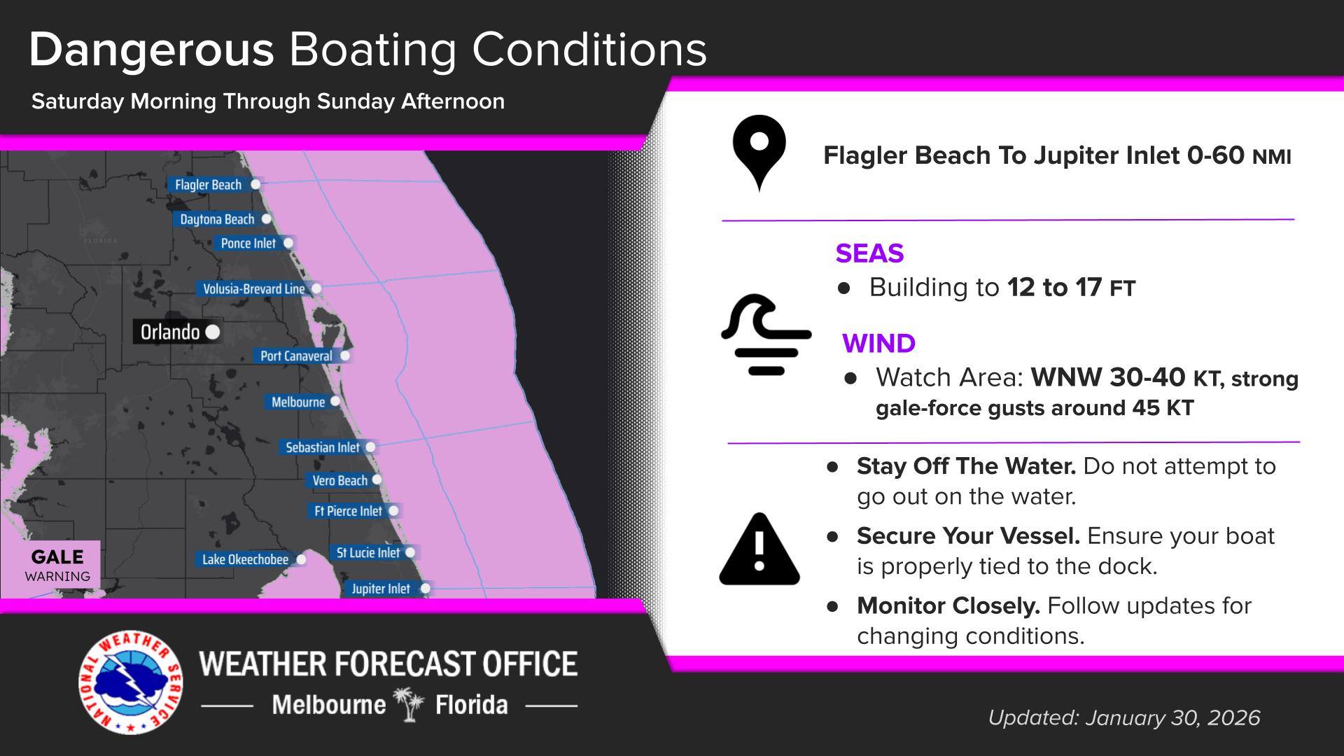
Boating and Marine Hazards
Boaters are strongly advised to stay off the water beginning Saturday. Strong winds and building seas are expected to produce hazardous marine conditions, with gale-force gusts possible. Conditions will be dangerous for small craft and potentially larger vessels as well.
Those with boats in marinas or on lifts should ensure they are properly secured ahead of the increase in wind.
Protect People, Pets, Plants, and Pipes
Residents should take standard cold-weather precautions, including:
■ Bringing pets indoors and providing warm shelter
■ Covering or bringing inside cold-sensitive plants
■ Dripping faucets overnight to help prevent frozen pipes
■ Checking on neighbors, especially those who may need assistance
Looking Ahead: The coldest temperatures are expected late Saturday night through early Sunday morning, with continued chilly mornings possible into early next week. While afternoon highs will rebound somewhat, conditions will remain well below typical January averages.
Local officials and meteorologists urge residents to continue monitoring forecasts and alerts, and to take all warnings seriously.
Now is the time to act. With wind and cold arriving in quick succession, early preparation will be key to minimizing impacts and staying safe during this historic cold outbreak.
 Related Story:
HOT OFF THE PRESS! January 19, 2026 Space Coast Daily News – Brevard County’s Best Newspaper
The post Brevard Under Freeze Warning: 50 MPH Wind Gusts, Temperatures in 20s Forecast Tonight into Sunday Morning appeared first on Space Coast Daily.